Jersey Maps and Orientation
(Jersey, Channel Islands, British Isles)
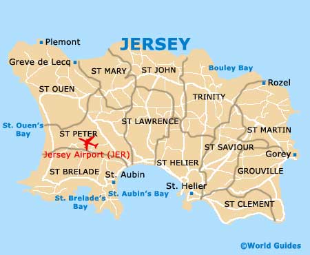
Located in the English Channel where it is the biggest and southerly of all the Channel Islands, Jersey is relatively small and measures just 14.5 km / 9 miles by 8 km / 5 miles. In general, the main resorts and beaches lie on the southern side of Jersey, while the northern areas tend to be more rugged and exposed.
Due to its size, you will never be more than minutes from your chosen destination on Jersey. However, much of the island features winding roads with a definite lack of signposts, which can mean that finding your way around is not easy and maps of Jersey are quite essential if you are planning to drive. Worth nothing, distances are rarely mentioned on signposts.
Maps and Orientation of the Island
Even when you enter many towns and villages, there is rarely an actual sign to say where you are, so you will often need to look out for landmarks along the way, such as beaches or the airport, or follow named 'A' roads.
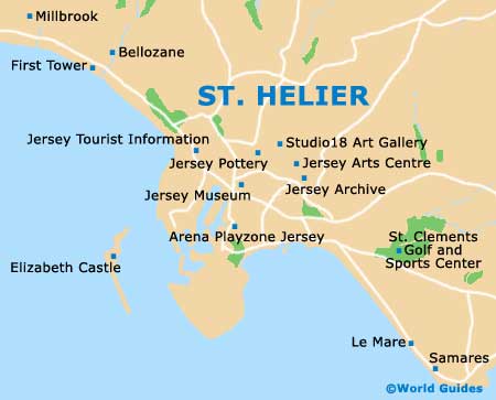
St. Helier is a busy town on Jersey and the island capital, being filled with one-way roads and confusing signage. Free maps are available from St. Helier's tourist office and are essential if you wish to make the most of your stay. The 'Jersey Recommended' map is amongst the best and this popular fold-up map clearly shows all of the main bays, beaches and attractions, with a handy secondary close-up map of the streets of St. Helier.
The island of Jersey is split into a total of 12 different parishes, which are listed below.
- Grouville (south-east)
- St. Brelade (south-west)
- St. Clement (south-east)
- St. Helier (south)
- St. John (north)
- St. Lawrence (south / central)
- St. Martin (east)
- St. Mary (north / north-west)
- St. Ouen (north-west)
- St. Peter (west)
- St. Saviour (south-east)
- Trinity (north-east)
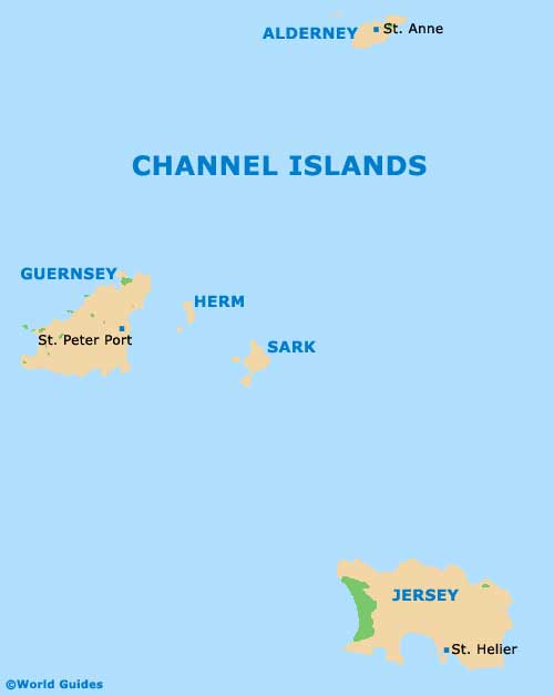
Map of the Channel Islands
Map of Jersey
Map of St. Hellier